Parks, waterfalls and walks list
……………with extra ideas and destinations further afield
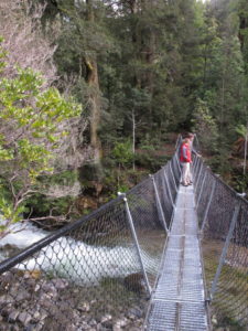
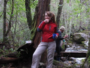
Bush track (your host)
Please note that the natural attractions shown vary in driving distance and time to reach. Times shown are only for the walk. Availability can vary with the season. Contact us.
Walk/track classification: W1, W2 provide the best grades in built structures and paths, while moderate risks and more natural conditions will be found using T1, T2 tracks. A full definition of these classifications is available off this site at the Parks and Wildlife Service.
Walks information as shown: Track/walk grade, distance one way (km), duration (return).
Narawntapu National Park:
A north coast national park special for long beaches, short nature walks, easy to see roaming wildlife and a bird hide at the lagoon.
Springlawn Nature Walk Narawntapu, W2, 1.646, < 2 h. Track extends to Archer’s Knob; beach walk option return (half day)
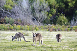
Kangaroos grazing at Narawntapu
Narawntapu, Archers Knob walk
Other north coast:
Low Head Penguin Rookery W2, 0.174, < 2 h
Meander Falls Forest Reserve:
Rainforest walk options in the beautiful World Heritage Area.
Meander picnic ground nature trail W2, 0.338, < 2 h
At Meander Falls Forest Reserve (World Heritage Area)
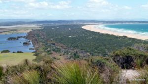
Bay of Fires Conservation Area:
Let’s just go to the beach. No crowds. Photography. Amazing birdlife. The Bay of Fires on Tasmania’s East Coast extends from Binalong Bay in the south to Eddystone Point in the north. The beaches can be accessed from north, middle and southern access points.
Mt William National Park lies at the northern end of the Bay and includes the lighthouse. The middle section is accessed via Policeman’s Point or the northern shore of Anson’s Bay. The southern section lies between Binalong Bay and The Gardens, accessed via Cosy Corner.
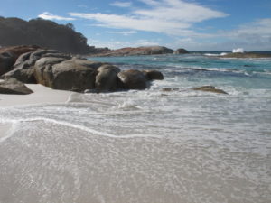
Bay of Fires CA
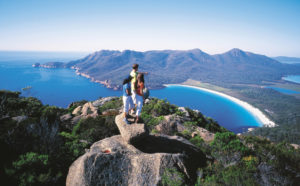
Freycinet National Park:
Wineglass Lookout W2 1.117, < 2 h (180 m altitude gain to 210- m).
Mt Amos T2, 1.864 km, 2 h to half day (Mt Amos 454 m elevation) ***Is not to be attempted in wet weather
Hazards Beach(return to carpark) T2, 5.772 km, half-one day
Wineglass Bay circuit T2, 11 km, 4-5 hours (continues on from Wineglass Bay lookout)
The Hazards and Coles Bay, Freycinet National Park
Mt Amos, Freycinet National Park
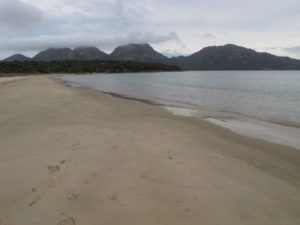
East coast other:
Friendly Beaches: Lookout W2, 0.103, < 2 h
Great Western Tiers and Mole Creek Karst National Park:
Liffey Falls (from top picnic area) W2, 0.905, < 2 h
Devils Gullet W2, 0.510, < 2 h
Alumn Cliffs/tulampanga W2, 0.779, < 2 h
Marakoopa Tourist Show Cave: an extensive river cave with glow-worms
Marakoopa Forest Walk W2, 0.439, < 2 h
King Solomans Tourist Show Cave: a more level cave walk with abundant crystal formations
King Solomans nature walk W2, 0.703, < 2 h
Westmorland Falls T2, 1.194, < 2 h
Honeycomb and other wild caves: if you want to include a limited wild cave experience as part of a TasGET trip, send us an enquiry. But for a half day or full day caving trip, see Wild Cave Tours
Picnic and waterfall, kooparoona niara
Central Plateau Conservation Area and World Heritage Area:
Steppes Cottage
Steppes Walk Bronze Sculptures T1, 0.659, < 2 h
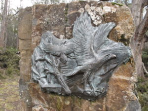
The Steppes bronze sculptures, Central Highlands
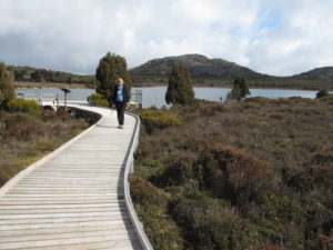
Pine Lake, Central Plateau, World Heritage Area
North-east highlands:
Mt Victoria summit T3, 2.169, < 2 h
Ralphs Falls W2, 0.557, < 2 h
Ralphs Falls – Cashs Gorge Circuit T1, 1.940, < 2 h
Evercreech Falls T1, 1.558, < 2 h
Mathinna Falls T1, 0.506, < 2 h
St Columba Falls W2, 0.628, < 2 h
Weldborough Pass rainforest walk T1, 0.355, < 2 h
Mountain Biking, Derby (half-day minimum)
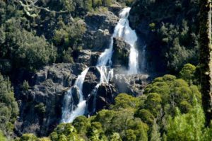
St Columba Falls, Pyengana
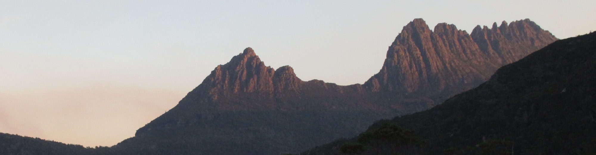
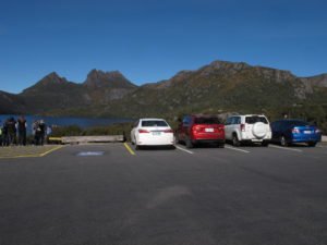
Cradle Mountain World Heritage Area:
These are just a few of the short walks available.
Cradle Vis Centre to Ronney Ck W2, 5.530, < 2 h
Enchanted nature walk W2, 1.146, < 2 h
Lake Dove circuit T1, 5.723, 2 h to < half day
Cradle Face track T2, extra 1.839, half- 1 day; extra Cradle Summit T2, 1.036, full day
Dove Canyon Visitor Centre to Knyvet Falls T1, 0.213, < 2 h
Lake Dove, Cradle Mountain, World Heritage Area
Ben Lomond via Jacobs Ladder scenic access road:
Tasmania’s northern ski fields (July to late September), with beautiful alpine flowers in summer
Alpine Village to Little Hell: About 1.5 hours return. From the top of Little Hell there are views across the southern part of the plateau to Stacks Bluff.
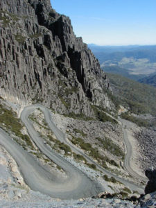
Jacobs Ladder Ben Lomond NP
Far north-west
Stanley, historic Highfield and the Nut or Table Cape tulips in spring? A long day’s drive through Tasmania’s lush, scenic, coastal north west, where fresh wild-caught fish with hot chips by the beach or the estuary is just perfect.
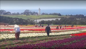
Table Cape Tulip Farm
Takayna/ Tarkine wilderness
This expansive area of rainforest, wild coastland and rivers is not suitable for day-trips from Launceston or Devonport. However, the full range of rustic to 4 ½ star accommodations and some of the best fine dining rewards 2 or 3 day trippers. Let’s talk.
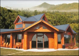
Tarkine Lodge
Tasmania’s south
Maria Island transfer? Perhaps you are interested in escorted trips to Mona or southern events? Let’s talk.

Sidney Nolan Snake, MONA
Back to Featured tours page